Are you curious to know what is FMB sketch? You have come to the right place as I am going to tell you everything about FMB sketch in a very simple explanation. Without further discussion let’s begin to know what is FMB sketch?
In the realm of land documentation and property ownership, certain terms and documents may seem unfamiliar to many. One such document is the FMB Sketch. FMB stands for Field Measurement Book, and the FMB Sketch is a visual representation of the land boundaries and measurements recorded in the Field Measurement Book. In this blog post, we will delve into the concept of the FMB Sketch, its purpose, and its significance in land documentation and property transactions.
What Is FMB Sketch?
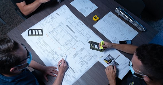
The FMB Sketch is a detailed and accurate representation of the land boundaries and measurements derived from the Field Measurement Book. The Field Measurement Book contains detailed measurements and descriptions of land parcels, including their boundaries, dimensions, and adjacent landmarks. The FMB Sketch visually represents this information, typically in the form of a map or plan, providing a clear depiction of the land and its boundaries.
Purpose Of The FMB Sketch
The FMB Sketch serves several purposes in land documentation and property-related matters:
- Identification And Verification: The FMB Sketch plays a vital role in identifying and verifying the boundaries of a particular land parcel. It provides a visual reference for land surveyors, government officials, and individuals involved in property transactions to ensure that the land’s physical boundaries align with the recorded measurements.
- Legal Documentation: The FMB Sketch is often used as a legal document to establish and authenticate land ownership. It serves as evidence of the land’s boundaries and dimensions, providing clarity and preventing disputes related to encroachments or conflicting claims.
- Land Record Maintenance: FMB Sketches are maintained by government authorities responsible for land records and cadastral surveys. These sketches serve as an essential component of land documentation systems, helping to maintain accurate and up-to-date records of land parcels within a jurisdiction.
- Property Transactions: When buying or selling land, the FMB Sketch is commonly required to verify the boundaries and dimensions of the property. Prospective buyers can reference the FMB Sketch to ensure that the land they intend to purchase aligns with their expectations and legal requirements.
- Resolving Boundary Disputes: In cases of boundary disputes between neighboring landowners, the FMB Sketch becomes a crucial reference point. It helps in resolving conflicts by providing an objective representation of the land’s boundaries, minimizing ambiguity and facilitating a fair resolution.
Significance Of The FMB Sketch
The FMB Sketch holds significant importance in land documentation and property transactions:
- Accuracy And Clarity: The FMB Sketch provides a clear and accurate visual representation of the land’s boundaries and dimensions, ensuring that the recorded information is easily understood and verifiable.
- Legal Protection: By relying on the FMB Sketch, property owners can safeguard their land rights and protect themselves from potential encroachments or boundary disputes. It serves as a documented proof of the land’s legitimate boundaries.
- Transaction Facilitation: The FMB Sketch expedites property transactions by offering a reliable reference for buyers, sellers, and legal authorities involved in the process. It helps in avoiding ambiguity and potential conflicts, streamlining the transactional procedures.
- Preservation Of Land Records: FMB Sketches aid in the systematic maintenance of land records, contributing to efficient land administration and preventing inconsistencies in land documentation.
Conclusion
The FMB Sketch plays a crucial role in land documentation, property transactions, and resolving boundary-related disputes. It provides a visual representation of the land’s boundaries and measurements, derived from the Field Measurement Book. With its accuracy and legal significance, the FMB Sketch offers clarity, authenticity, and protection to landowners and prospective buyers. By understanding the purpose and significance of the FMB Sketch, individuals can navigate land-related matters with confidence and ensure the integrity of their property rights.
FAQ
What Is FMB Sketch In Tamil Nadu?
FMB Sketch Online – The Field Measurement Book (FMB) drawing is a collection of map information held in bulk at each Tahsildar office by the government. The individual survey number drawings in FMBs are kept at a 1:1000 or 1:2000 scale. There are several different subdivisions for every survey number.
What Is The Full Form Of FMB Copy?
This service facilitates the citizen in getting copy of FMB (Field measurement Book), which will have the field measurement sketches of all individual Fields.
How To Apply For FMB Sketch In Tamil Nadu?
Apply In Person
- To obtain the FMB (Field Measurement Book) sketch copy of your land, visit the Taluk office of your respective area. …
- Visit the Office and get the request form to obtain the FMB sketch copy of your land by providing the Survey number in the relevant department.
What Are The Units Used In FMB?
The FMB’s also depicts the dimensions of each field boundaries and the sub divisions. The unit is called links. For example if number is 250, it means 2 full chains( each chain = 100 links) and 50 links. 1 full chain = 66 feet.
What is FMB sketch Tamilnadu
What is FMB sketch?


